Too much of a good thing: Damaging atmospheric rivers likely to increase flood risk
Ryan Hoffman / Tahoe Daily Tribune
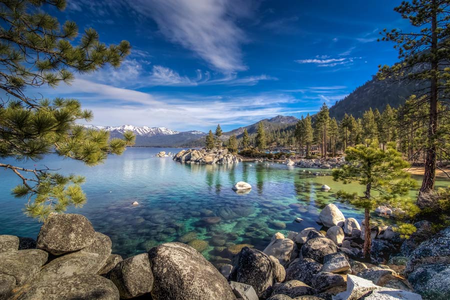
Winter in the Truckee River Watershed can be a picturesque wonderland of snow-capped peaks and snow sports. However, it is also a season of heightened flood risk that we expect to increase as our community continues to feel the impacts of climate change.
The primary ingredients for flooding in the region are ‘atmospheric rivers.’ These long, narrow corridors of water vapor in the atmosphere carry moisture from the tropical Pacific Ocean to the mid-latitudes, home to Tahoe and the Truckee River Watershed. On average, a single atmospheric river transports the equivalent of 7-15 Mississippi Rivers worth of water.
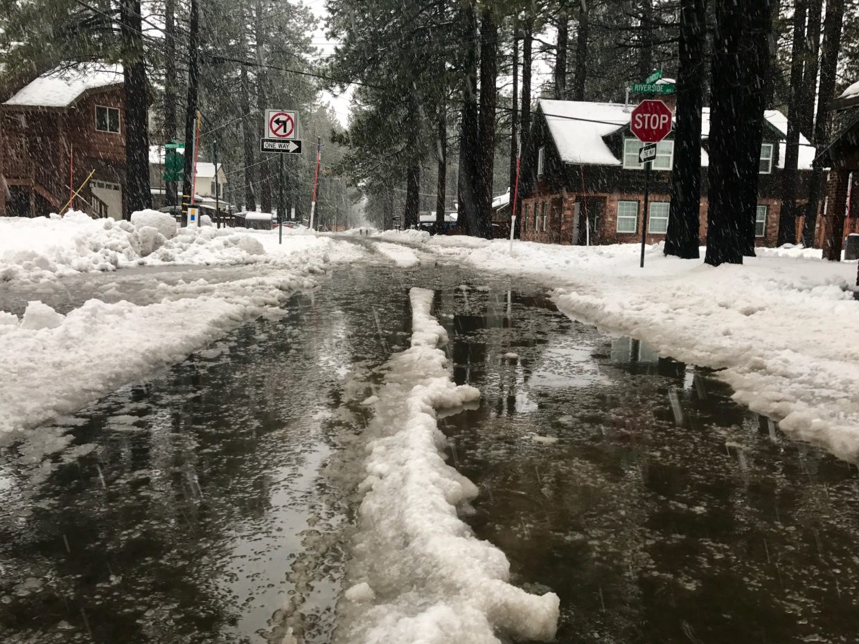
While we rely on atmospheric rivers to fill Lake Tahoe and the six downstream reservoirs, flooding can occur when we receive too much water too quickly. Throughout history, all the largest peak flows on the Truckee River have been associated with atmospheric rivers. These events bring significant damage and disruption to the Tahoe Basin and downstream communities. Multiple atmospheric rivers arriving in close succession, as occurred this winter and in 1997, 2005, and 2017, can be particularly destructive because they compound the effects of a single storm and limit communities’ ability to react. The 1997 flood caused an estimated $700 million in damages and left downtown Reno under feet of water.
While atmospheric rivers are the primary ingredient, a flood recipe includes several others. Warmer storms cause more moisture to fall as rain rather than snow, increasing the runoff into streams and rivers and the risk of rain-on-snow flooding. The average elevation in the Tahoe Basin is around 7,000 feet, right in the range of where the rain-snow line typically falls, which makes flood forecasting in our region especially challenging. The strength of the rain shadow – or the amount of precipitation that falls on the leeward (eastern) side of the Sierra crest – also influences precipitation amounts and flood potential and is similarly difficult to forecast. Finally, conditions on the ground before the storm arrives, including antecedent soil moisture, the ability of the snowpack to hold or release rainwater (a function of depth and temperature), and reservoir levels, can exacerbate or mitigate flooding. Rain falling on the leeward (western) side of the Sierra combined with saturated soils, a ‘ripe’ snowpack ready to melt, and full reservoirs mean that precipitation from atmospheric rivers has nowhere to go but downstream, increasing flood risk.
Climate change will likely cause warmer and more severe atmospheric river events in the Truckee River Watershed, significantly increasing flood impacts in this region. Rising temperatures can cause more precipitation to fall as rain instead of snow, increasing the likelihood of flooding downstream. The rain shadow effect may weaken with climate change, allowing more precipitation to cross up and over the crest of the Sierra Nevada to fall on eastern slopes. Additionally, studies show that climate change may increase the frequency of atmospheric river conditions by up to 50%, exacerbating flood risk in the region and potentially tripling flood damages.
We can mitigate the impacts of flooding by taking steps now to prepare and adapt. Improving storm forecasting and monitoring, along with research that helps to better understand how soils and snowpack contribute to flooding, will enable us to better predict future floods.
Additionally, local governments can invest in improvements to ‘hard’ infrastructure (e.g., transportation, power, communications, flood protection) and restoring ‘soft’ infrastructure (e.g., forest, floodplain, wetland ecosystems). Emergency services can invest in improvements to early warning systems and emergency preparation and response coordination. Residents can make their homes more flood-resistant by elevating utilities, increasing drainage, and using sandbags. Land use planning can help to reduce the risk of flooding by avoiding development in flood-prone areas.
Understanding the potential flood impacts, specifically on historically underserved areas, can promote proactive flood mitigation efforts. A new project in the region, called ARkStorm@Tahoe 2.0, will look at the flooding from a hypothetical month-long sequence of atmospheric rivers in the Truckee River Watershed, projecting impacts to our infrastructure and structures and identifying the most affected populations.
With the likelihood of more frequent and severe floods increasing due to climate change, we must act now to understand and adapt to these changing conditions and ensure a safer future for our community.
Mariana Webb is a Ph.D. student in the Graduate Program of Hydrologic Sciences (GPHS) at the University of Nevada Reno studying flooding impacts from atmospheric rivers. Adrian Harpold is an associate professor in the Department of Natural Resources and Environmental Science at University of Nevada, Reno. Christine Albano is an assistant research professor in the Division of Hydrologic Sciences at the Desert Research Institute in Reno, NV. Dr. Harpold has been a member of the Tahoe Science Advisory Council since 2019. Learn more about the council’s work at tahoesciencecouncil.org.


Support Local Journalism
Support Local Journalism
Readers around the Lake Tahoe Basin and beyond make the Tahoe Tribune's work possible. Your financial contribution supports our efforts to deliver quality, locally relevant journalism.
Now more than ever, your support is critical to help us keep our community informed about the evolving coronavirus pandemic and the impact it is having locally. Every contribution, however large or small, will make a difference.
Your donation will help us continue to cover COVID-19 and our other vital local news.