Watershed moment; From the snowy mountain peaks to a dead-end desert lake, follow the flow of Tahoe’s waters
Provided / CTC
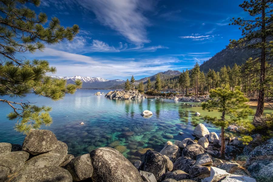
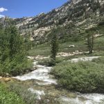
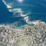
On a warm spring day, snowpack high in the peaks surrounding Lake Tahoe begins to melt. The water trickles down the granite rocks finding its way into winding seasonal creek beds, flushing into large meadows, flowing into backcountry alpine lakes, and joining larger streams as it makes its way down the mountain into the big blue lake below.
Tahoe’s watershed — the land area that channels rainfall and snowmelt into a common body of water — is unique for a number of reasons. First and foremost is the size of the lake itself. The lake makes up 38% — a surface area of 192 square miles — of the 501-square-mile watershed, which is a major factor in the lake’s famed clarity.
“The ridgelines that define the watershed boundaries are really obvious when you look at a map. The whole basin is basically a big bowl,” explains Theresa Cody, a hydrologist with the U.S. Forest Service Lake Tahoe Basin Management Unit. “The watershed for Lake Tahoe is completely self-contained, so all of the water that comes into the lake comes from rain and snow that falls in the basin, so in that sense, it’s a really unique situation where everything that happens in the basin affects the lake.”
While most watersheds eventually drain into the ocean, Tahoe’s water flow does not. Sixty-three tributaries push water into the lake, along with the precipitation that falls directly onto the surface. While the Tahoe Basin is its own contained watershed, it is part of the larger watershed known as the Truckee River Watershed. Tahoe’s sole outlet, the Truckee River, flows 121 miles northeasterly from the dam at Tahoe City, depositing water in several reservoirs along the way, before terminating in Pyramid Lake, roughly 40 miles north of Reno.
Named for its pyramidal limestone formation, the terminal lake is the largest remaining remnant of the ancient Lake Lahontan, a massive inland sea that once covered most of western Nevada. For the Pyramid Lake Paiute Tribe, who has lived off of the lake for centuries, it has always been known as Kooyooe Pa’a Panunadu, or Cui-ui Standing Water, named for the large sucker fish that can only be found there. With no outlet, water leaves Pyramid Lake through evaporation or subsurface seepage, which results in a slightly salty lake — approximately one-sixth the salinity of seawater.
FLOW WHAT?
Understanding the flow of water through the Tahoe Basin is important for the health of the lake and its surrounding environment — but it was not always a priority.
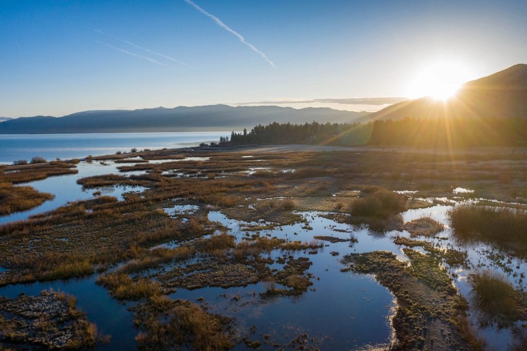
Tahoe contains approximately 21,944 acres of stream environment zones — meadows, marshes, streams, streambanks, and beaches — that act as natural water filters, sifting out nutrients and fine sediments, reducing erosion, and maintaining Tahoe’s famed clarity.
Decades of development to meet the increasing tourism demands resulted in meadows, marshes and wetlands that were filled to make buildable land. Streambeds and riverbeds were straightened and diverted to accommodate businesses, neighborhoods, hotels and parking lots. As a result, pollution from roadways and wastewater flowed into the lake without a large portion of its natural filtration system in place. By the 1980s, around 4,400 acres of these sensitive SEZs were impacted and water clarity had plummeted.
Thankfully, stakeholders around the lake have been working together to right these environmental wrongs by reviving disturbed wetlands through coordinated restoration projects. To date, more than 1,100 acres of SEZs have been restored.
In 2022, the California Tahoe Conservancy and its partners completed the largest wetland restoration undertaken in Tahoe: revitalization of a portion of the 1,600-acre Upper Truckee Marsh. This critical area — where nearly a third of the basin’s land area drains into Lake Tahoe — had been heavily degraded by the mid-20th-century construction of the Tahoe Keys neighborhood in South Lake Tahoe. The project restored 250 acres of floodplain by reconnecting the Upper Truckee River to its historic channels through the heart of the marsh and added 12 acres of new wetlands near the Tahoe Keys Marina.
“So much of the degradation we’ve seen in the watershed comes from the way towns were built out — filling wetlands, straightening creeks, putting up parking lots. Our job now is to reverse that where we can,” explains Stuart Roll, senior environmental scientist with the California Tahoe Conservancy. “A lot of the work we do focuses on restoring natural processes. That means things like reactivating floodplains, reconnecting streams to their channels, and trying to undo some of the legacy impacts of development from decades ago.”
Another key portion of the marsh is now poised to be restored thanks to a recent acquisition of a 31-acre parcel that houses the soon-to-be demolished Motel 6, restaurant building and parking lot in the historic floodplain. Public comment is currently underway for the project with completion estimated in 2027.
“This is one of the last remaining large pieces of undeveloped land in South Lake Tahoe. The Conservancy acquired it to remove old infrastructure, reestablish wetlands, and improve stormwater retention. It’s a big deal for water quality,” notes Roll. “The kind of restoration we’re doing also helps build resilience. When you give a river room to move or expand a wetland, you’re not just improving water quality — you’re buffering the system against flooding, drought and wildfire. Lake Tahoe is so pristine that even relatively small impacts can have a large effect.”
CLIMATE EXTREMES
As climate change fuels more unpredictable weather patterns in the Tahoe Basin, understanding, protecting, and restoring the region’s wetlands has never been more critical.
The accumulated snowpack in the mountains is Tahoe’s reserve of water that, in ideal circumstances, melts slowly during the spring and summer to flow down to the lake. But if the snow melts too quickly from extreme heat or rain-on-snow events, it can overwhelm the streams and other wetlands, resulting in erosion and more nutrients flowing into the lake.
“We have been seeing drier dries and wetter wets,” explains Cody. “It’s not necessarily just warming or just drying; it’s the swings that are getting more intense. These intense rain-on-snow events are becoming more common, which can cause flooding and have serious effects on infrastructure and water quality. We’re trying to manage for extremes now, not averages.”
Wetlands play a vital role in buffering against those extremes. By restoring natural floodplains, reconnecting streams, and revitalizing meadows, land managers are helping the watershed become more resilient to climate shocks.
“One of the ways we can help combat climate change is through restoring meadows so that they store much more carbon instead of releasing a lot of carbon, which they can do in an impacted state,” says Roll. “Ensuring that the stream channels and banks are stable and have good vegetation that can bounce back from climate change and these extreme events is really critical, too.”
“Climate is definitely an overarching concern,” Roll adds. “And we’re seeing its impacts happening in real time.”
SIDEBAR: WATERSHED FACTS
The U.S. Geological Survey divides the country into 22 hydrologic regions. Tahoe is part of the Great Basin, which is the largest area of contiguous watersheds with no outlets to the ocean. It covers almost all of Nevada, a large swath of Utah, and smaller sections of California, Idaho, Oregon, Wyoming and Baja California.
The largest watershed in the U.S., the Mississippi River Watershed, stretches from the Rockies to the Appalchians, draining 1.15 million square miles from all or parts of 31 states and two Canadian provinces, according to the National Oceanic and Atmospheric Administration.
Editor’s note: This article originally appeared in the Summer 2025 edition of Tahoe Magazine.


Support Local Journalism
Support Local Journalism
Readers around the Lake Tahoe Basin and beyond make the Tahoe Tribune's work possible. Your financial contribution supports our efforts to deliver quality, locally relevant journalism.
Now more than ever, your support is critical to help us keep our community informed about the evolving coronavirus pandemic and the impact it is having locally. Every contribution, however large or small, will make a difference.
Your donation will help us continue to cover COVID-19 and our other vital local news.