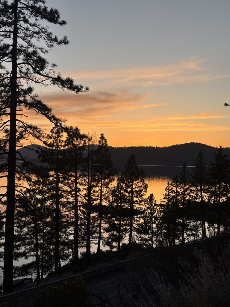
Chasing the sun; Sunrise and sunset hikes
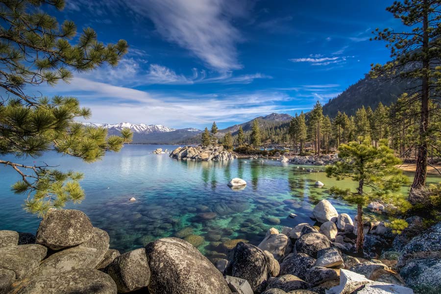
It’s mind blowing how something so captivating and subliminal can happen twice a day and humans all around the world forget to watch it happen. The sun rises and sets like clockwork. Whether society is ready for it or not. It’s expected and falls into the long list of everyday things but it really should be celebrated. It should be a time to set aside all of life’s fluff for a few moments of gratitude and grounding. How can something so far away dance its light off the clouds and paint our skies with oranges, purples, yellows and pinks? The mixture of colors is unique every single day. No two sunrises or sunsets will ever be the same. And its expansiveness is truly radiant. Especially when it’s reflected off the glassy still water of Lake Tahoe.
There’s something special about purposefully reserving your morning or evening to hike to a high point and sit patiently waiting for the sun to do her thing. Whether creating a positive mindset for the day ahead with a sunrise or reflecting back on the day with a sunset, there are beaches all along the perimeter of Lake Tahoe that could very well do the job but why not take it a step further and complete a hike for that stunning view? It’s never not going to be worth it.
SUNRISE HIKES:
Basically anywhere along the west side of the lake from Tahoe City down through Rubicon Bay and a little into Emerald Bay is a good length of lake to watch the sun rise up over the Carson Range, a part of the Sierra Nevada. This is the California side of the lake. The secret to a good sunrise hike is finding a trail that elevates quickly and doesn’t take too long to get to the top because the whole way up will be in the dark and starting around anywhere from 5-6 a.m. to be able to get to the top by sunrise.
Eagle Rock Trail #1 RECOMMENDED SUNRISE HIKE
For a beautiful full view of the sunrise spreading across the whole lake, this is the perfect spot! It’s 0.7 miles and takes about 30 minutes of hiking total. There is a spot to pull off W Lake Blvd for parking but it is limited. The trail is well maintained and only gets rocky toward the very top. There are drop offs/cliffs at the top, so be smart and careful.
Vikingsholm Trail
Instead of hiking up, this hike takes you down the mountain from Highway 89 to where a 1929 castle sits on the beach. Vikingsholm is famous for its Scandinavian architecture previously owned by Lora Josephine Knight, a wealthy Chicago widow. There is free access to the beach with picnic tables. This trail is 1.7 miles total, has a 377 foot elevation change, and on average takes about an hour. There is a small parking lot with limited parking and there is a fee via a self-pay station. There is a viewpoint at the very beginning of the trail where hikers can sit and take in all of Emerald Bay and Fannette Island. The trail is wide, well-maintained, and easy to navigate. Remember though that this hike is backwards, it is all uphill and slightly steep the whole way back up to the parking lot.
Rubicon Point Lighthouse Trail
The focal point of this hike is the lighthouse that was originally built in 1916 to aid in ships and boats navigating the lake. To see the light-house, hikers will go on a 2.5 mile hike, with a 488 foot elevation gain, and spend about an hour and 15 minutes on the trail. This trail is a loop. There is a small parking lot so be sure to arrive early and there is a fee required.
SUNSET HIKES:
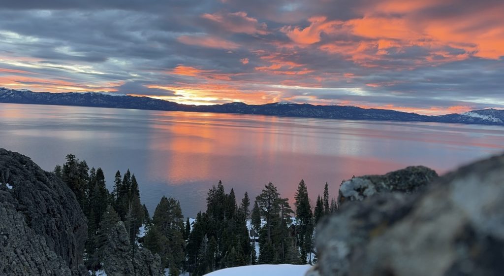
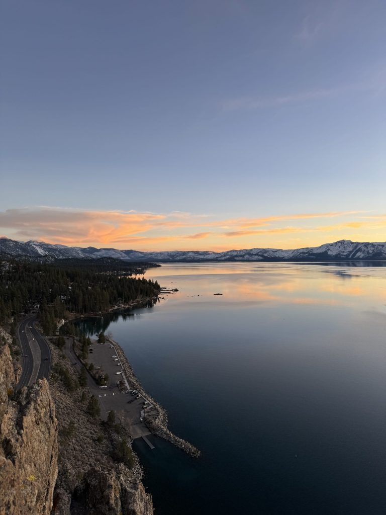
Opposite the sunrise stretch of lake is the East side of Lake Tahoe from Incline Village to South Lake Tahoe. The sun will set over part of the main mountains of the Sierra Nevada in the west.
Cave Rock Trail #1 RECOMMENDED SUNSET HIKE
Anyone who has driven on Highway 50 knows there is a short tunnel a few miles before hitting Zephyr Cove. What most people don’t realize is that there is a lookout on top of the tunnel and the trail that leads there is called Cave Rock Trail. It is less than a mile long sitting at 0.8 of a mile, takes less than 30 minutes round trip and is about an 118 foot elevation gain total. Parking is free in the small lot at the trailhead.
The trail is fairly easy but it does require some light rock climbing at the end to get on top of the tunnel where hikers will find themselves feeling like they’re on top of the world with a panoramic view of the lake! This is a popular spot so expect other hikers. There are drop offs/ cliffs at the top so be smart and careful.
Tunnel Creek Trail
This trail is an extension of Monkey Rock. If hikers are looking for a longer hike, passing Monkey Rock and continuing on until the trail. intersects the Tahoe Rim Trail and then heading back down will make for a 7 mile hike. This takes about 3 hours and 45 minutes. Parking is the same as explained above.
Tahoe East Shore Trail
For a much simpler trail leaving from the same parking lot as Monkey Rock and Tunnel Creek, consider the Tahoe East Shore Trail. This trail is 5.2 miles stretching from Tunnel Creek Cafe to Sand Harbor. Hikers do not need to complete the 5.2 miles to enjoy the trail and can turn around at any point if they wish to. The trail is completely asphalt or pavement, has railings on a lot of it, and there are benches along the way to take breaks if needed. It almost entirely runs along the shore of the lake with a tunnel or veering only slightly away in a few places. The full trail will take about 2 hours total to complete.
Secret Cove Beach This trail leads to a beach where nudity is present
There is a small parking lot that is free to park in. The hike is only 0.9 miles down to the beach where hikers will find a beautiful secluded cove with small parts of beach or rock formations to sit on and watch the sunset. It takes about 30 minutes roundtrip. From Secret Cove, there are several options to extend the hike in length to further beaches including Boater’s Beach, Creek Beach, Secret Harbor Beach, and Whale Beach (nudity present) all of which offer the same vibe as Secret Cove. Secret Cove Beach to Whale Beach is the longest stretch of hike for a total of 3.1 miles roundtrip.
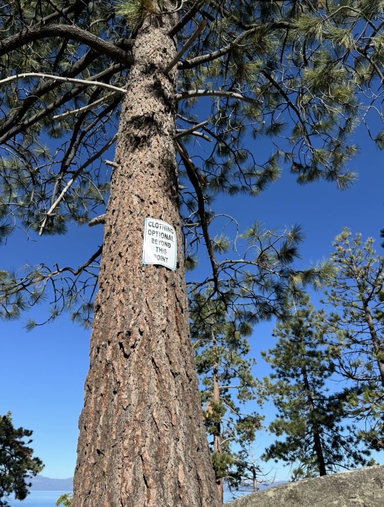
Whale Beach Trail This trail leads to a beach where nudity is present
Whale Beach can also be accessed by Whale Beach Trail. From Nevada State Route 28, it is a 1.7 mile trail there and back, taking about 50 minutes to complete.
Chimney Beach Walk
A short 0.8 mile hike from a small lot with free parking. This takes about 25 minutes to complete. It is a beautiful place to watch the sunset. Chimney Beach does connect to Secret Cove Beach (nudity is present) via Chimney Beach Trail to Secret Cove Beach Trail if hikers wish to extend their journey.
Editor’s note: This article originally appeared in the Summer 2025 edition of Tahoe Magazine.


Support Local Journalism
Support Local Journalism
Readers around the Lake Tahoe Basin and beyond make the Tahoe Tribune's work possible. Your financial contribution supports our efforts to deliver quality, locally relevant journalism.
Now more than ever, your support is critical to help us keep our community informed about the evolving coronavirus pandemic and the impact it is having locally. Every contribution, however large or small, will make a difference.
Your donation will help us continue to cover COVID-19 and our other vital local news.