Weather Report: First winter storm of the season heads for Tahoe
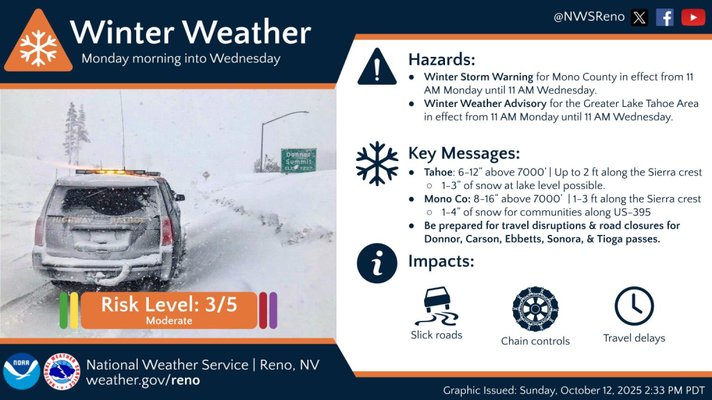
Get the snow shovels and ice scrapers ready — the first winter storm of the season is heading toward Tahoe. The National Weather Service has issued a winter weather advisory for the Greater Lake Tahoe Area, in effect from 11 a.m. Monday to 11 a.m. Wednesday.
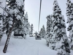
Heavy snow is expected above 7,000 feet, with 6 to 12 inches of accumulation possible and up to a foot along the Sierra Crest. Forecaster Bryan Allegretto anticipates 1 to 6 inches of wet snow around the Tahoe Basin. Ridge winds could gust up to 60 mph.
The storm could create hazardous travel conditions, particularly through mountain passes such as Donner Pass, Carson Pass and Ebbetts Pass. Drivers should expect delays during the Monday evening and Tuesday morning commutes, and gusty winds could bring down tree branches.
The weather service urges motorists to slow down and use caution while traveling, and to call 511 for the latest road conditions.
“The storm clears through the day on Wednesday,” said Allegretto. “Then mostly sunny Thursday through the weekend with milder temperatures as high pressure builds in over the region,”
According to the National weather service, forecast models suggest another storm may be on the horizon by late next weekend, though there remains a wide range of possible tracks — from brushing the Oregon border to a more direct impact on the Sierra.


Support Local Journalism
Support Local Journalism
Readers around the Lake Tahoe Basin and beyond make the Tahoe Tribune's work possible. Your financial contribution supports our efforts to deliver quality, locally relevant journalism.
Now more than ever, your support is critical to help us keep our community informed about the evolving coronavirus pandemic and the impact it is having locally. Every contribution, however large or small, will make a difference.
Your donation will help us continue to cover COVID-19 and our other vital local news.